A Measured Survey is a detailed drawing showing the dimensions, locations, and permanent features of your property, which can be a building or land.
This type of survey is essential for identifying the layout of your property and its permanent attributes.
According to the Royal Institution of Chartered Surveyors (RICS), measured surveys are usually drawn up to a scale of 1:100 for buildings, 1:50 for listed buildings, and 1:250 for land.
The location of your property is determined by GPS (Global Navigation Satellite System) coordinates or can be created locally specifically for your property.
The positions are relative to their reference points, such as GPS or the local established control points.
The Land Registry emphasizes the importance of accurate location data, which is then used to establish the property’s boundaries and create a definitive record.
Permanent features are a crucial aspect of a measured survey, as they define the characteristics of your property.
Walls
Windows
Doors
Beams
Columns
Built-in cabinets/wardrobes
Ponds
Trees
Pavement
Street furniture
According to the UK’s Planning Portal, permanent features can be used to distinguish between buildings and land, and are often referenced in planning applications and insurance policies.
As highlighted by the Royal Institution of Chartered Surveyors (RICS), measured surveys provide a detailed record of these features, allowing for accurate assessments and decision-making.
How to carry out a measured building survey (Do it yourself)?
How to carry out a measured building survey (Do it yourself)?How to carry out a measured building survey (Do it yourself)?
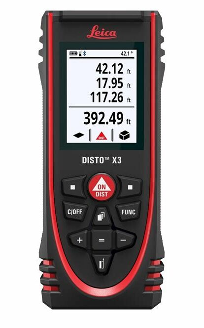
If you want to undertake a measured building survey, a laser distance meter can be extremely handy and accurate. Laser measures come in smaller and larger sizes, with a variety of functions to suit homeowners and tradespeople or professionals: laser distance meters are frequently used by electricians, estate agents, contractors, surveyors, insurance loss adjusters, flooring professionals, plumbers, and the like for the everyday accurate measuring of buildings.
Using a laser distance meter is a convenient alternative to traditional tape measures. Simply line up the device at the end of the wall or doorway and aim the laser beam at the desired point. Press the button, and the device will display the length of the space measured on the screen. Some laser distance meters also feature calculator functions for adding distances together, calculating volumes and areas, and determining the length of materials needed for new carpeting.
There are several advantages to using a laser distance meter over a traditional tape measure. Digital laser technology allows for quick and efficient work without the inaccuracies caused by tape measures that are not straight or properly aligned. Additionally, laser distance meters enable solo work, as conventional tape measures often require two people. Measuring roof height is particularly challenging without a digital tape measure, and reading a digital display is generally easier than checking lines on a conventional tape measure.
Once you’ve got your laser distance meter and you’re confident using it, you’re ready to do your measured building survey. For this, you’ll need to make sure you’ve got paper, a clipboard, and a pen to hand, as you’ll need to write down all of your measurements really clearly and carefully. If you’re an architect, this process is second nature, but for most amateur surveyors, you will need to be careful to ensure high levels of accuracy. Some spare batteries, a camera, a traditional tape measure and work boots/a high visibility jacket might also come in handy depending on the location, too.
Once you’ve got your laser distance meter and you’re confident using it, you’re ready to do your measured building survey. For this, you’ll need to make sure you’ve got paper, a clipboard, and a pen to hand, as you’ll need to write down all of your measurements really clearly and carefully. If you’re an architect, this process is second nature, but for most amateur surveyors, you will need to be careful to ensure high levels of accuracy. Some spare batteries, a camera, a traditional tape measure and work boots/a high visibility jacket might also come in handy depending on the location, too.
It pays to look around the whole building first, if you’re not already familiar with it. As you come to measure each room, sketch it out first on your paper, and add your measurements to the sketches as you go. Working in different colours for windows, steps, and wall heights can be useful so you don’t get confused by your sketches later.
It pays to look around the whole building first, if you’re not already familiar with it. As you come to measure each room, sketch it out first on your paper, and add your measurements to the sketches as you go. Working in different colours for windows, steps, and wall heights can be useful so you don’t get confused by your sketches later.
As you carry out your measured building survey, you will need to be methodical. As you begin measuring, start at the door and work consistently either clockwise or anti-clockwise around the room, so you don’t miss anything. You will need to measure window heights, floor thickness (try around the stairs), wall thickness, elevations, and roof height and angle, too. Take as many measurements as you can, and then lots of photos too to help with the interpretation of your results when you’re done.
While it’s perfectly possible to carry out your own survey for DIY purposes, when it comes to planning permits, you will need a measured building survey from a qualified and professional measured buidling surveyor. Architects too will require accurate technical drawings which can only be produced by a professional.
A topographical survey is used to produce a detailed map of all man-made and natural features within a given area. Also known as a land survey, they are used to inform a variety of property management, development and redevelopment projects. In addition to planning purposes, a survey might also be needed for record keeping. Data collected from a survey is used in variety of plans, from standard drawings or plans on paper to advanced 3D digital models.
Purposes of a Topographical Survey
A survey might be needed for a variety of record and planning purposes. Surveys are then used by architects and builders to develop or redevelop the land or property on the site. They can also be used for modelling and visualisation purposes, or simply for maintaining historical records for the site. A survey might also be used to help manage and monitor a site, for example to help manage and mitigate land erosion.
Surveys might be needed for various projects, including designing a road or highway, railway, airport, housing estate, or commercial development. Surveys may also be needed to obtain the location of neighbouring properties and boundaries when dealing with the placement of a party wall or the sale and acquisition of land. Surveys are also helpful for locating specific details about an area, such as the location of trees and tree canopies or any surface features and services that might affect a property or the development of the land.
What’s Included in the Survey
A topographical survey measures the boundary, height and features of an area of land including the area around an existing structure. Typically, a survey will include measurements for any existing buildings and structures on the site. It will also include details on the boundary of the site. Information on the terrain will also be included, such as a grid of levels, ground surfaces, and the position of shrubs and trees. A typical survey also includes all utilities and services on the site such as drainage details and the position of service covers or manholes.
A topographical survey measures the boundary, height and features of an area of land including the area around an existing structure. Typically, a survey will include measurements for any existing buildings and structures on the site. It will also include details on the boundary of the site. Information on the terrain will also be included, such as a grid of levels, ground surfaces, and the position of shrubs and trees. A typical survey also includes all utilities and services on the site such as drainage details and the position of service covers or manholes.
A survey may also include additional detail beyond the boundary of a site, such as the location of utilities including utility poles and manholes that might affect the site being surveyed. The survey might include the location of nearby trees and buildings that could also affect the project. Additional details can be included depending on individual needs, such as details and measurements on any features next to the site or underground services and features. Generally, surveys with a higher level of detail will cost more than one with less information.
Determining the Level of Detail
The amount of information included in a land survey often depends on individual project and client requirements.
The details included in the survey are informed by the area that is being surveyed as well as the detail and accuracy required.
For example, a survey based on a scale of 1:100 will be more accurate than one done to a scale of 1:200 or 1:500.
The scale will also determine the level of detail that will be included.
Clients should always speak with land surveyors about their requirements before the survey is undertaken, including the extent of the survey area and the level of detail required.
Generally, surveys with a higher level of detail will cost more than one with less information.
The survey might include the location of nearby trees and buildings that could also affect the project.
Additional details can be included depending on individual needs, such as details and measurements on any features next to the site or underground services and features.
Measuring buildings can be done with a laser distance meter, a handy and accurate tool.
Laser measures come in different sizes and have various functions to suit different needs.
These tools are used by electricians, estate agents, contractors, surveyors, insurance loss adjusters, flooring professionals, plumbers, and others for accurate measuring.
To use a laser distance meter, line it up from the end of the measurement point, aim the laser beam at the target point, and press a button.
The meter will display the length of the space measured on the screen. Some laser distance meters also include calculator functions.
There are plenty of advantages to using a laser distance meter over a traditional tape measure. This digital laser technology allows you to work quickly and efficiently, without the inaccuracies caused by tape measures that aren’t straight or lined up properly. It also allows you to work alone- conventional tape measures really need two people. If you’re measuring roof height, it’s next to impossible without a digital tape measure. Reading a digital display is also easier than checking lines on a conventional tape measure, and of course the calculator function provided on some models is invaluable.
Once you’ve got your laser distance meter and you’re confident using it, you’re ready to do your measured building survey. For this, you’ll need to make sure you’ve got paper, a clipboard, and a pen to hand, as you’ll need to write down all of your measurements really clearly and carefully. If you’re an architect, this process is second nature, but for most amateur surveyors, you will need to be careful to ensure high levels of accuracy. Some spare batteries, a camera, a traditional tape measure and work boots/a high visibility jacket might also come in handy depending on the location, too.
It pays to look around the whole building first, if you’re not already familiar with it.
As you come to measure each room, sketch it out first on your paper, and add your measurements to the sketches as you go.
Working in different colours for windows, steps, and wall heights can be useful so you don’t get confused by your sketches later.
As you carry out your measured building survey, you will need to be methodical.
As you begin measuring, start at the door and work consistently either clockwise or anti-clockwise around the room, so you don’t miss anything.
You will need to measure window heights, floor thickness (try around the stairs), wall thickness, elevations, and roof height and angle, too.
Take as many measurements as you can, and then lots of photos too to help with the interpretation of your results when you’re done.
While it’s perfectly possible to carry out your own survey for DIY purposes, when it comes to planning permits, you will need a measured building survey from a qualified and professional measured buidling surveyor.
Architects too will require accurate technical drawings which can only be produced by a professional.