Introduction to Mobile Mapping Technologies
Mobile mapping technologies represent a transformative approach to geospatial data collection, integrating various sensor technologies and computational tools to gather location-based information with high efficiency and accuracy.
Mobile mapping utilizes mobile platforms, such as vehicles or drones, equipped with advanced sensors including Global Positioning Systems (GPS), laser scanners, and cameras.
This dynamic method allows for the rapid collection of data over large areas, providing timely solutions for sectors such as urban planning, infrastructure management, and environmental monitoring.
The significance of mobile mapping technology lies in its ability to revolutionize geospatial data collection processes.
As urban environments grow increasingly complex and rich in data, traditional surveying methods that rely on manual measurements and stationary equipment become less effective.
Mobile mapping meets the demand for speed and extensive coverage by enabling simultaneous data collection across large areas.
This capability facilitates more informed decision-making and improved resource management.
Historical Development of Mobile Mapping Systems
The history of mobile mapping systems dates back to the late 20th century with the evolution of satellite-based positioning technology that began to transform location services. Early systems relied on GPS for basic navigation and mapping. As technology evolved, the integration of advanced photographic imaging and laser scanning capabilities significantly improved initial methodologies.
The history of mobile mapping systems dates back to the late 20th century with the evolution of satellite-based positioning technology that began to transform location services. Early systems relied on GPS for basic navigation and mapping. As technology evolved, the integration of advanced photographic imaging and laser scanning capabilities significantly improved initial methodologies.
In the 1990s, the introduction of LiDAR (Light Detection and Ranging) sensors began reshaping mobile mapping, allowing for detailed terrain analysis through high-density point cloud data. The enhancement of these functionalities, combined with the growing accessibility of high-quality sensors and imaging systems, led to more sophisticated vehicle-mounted mobile mapping platforms in the early 2000s. This period marked a pivotal shift, as institutions recognized the immense potential of mobile mapping technologies to optimize data collection processes and enhance accuracy for various applications.
In the 1990s, the introduction of LiDAR (Light Detection and Ranging) sensors began reshaping mobile mapping, allowing for detailed terrain analysis through high-density point cloud data. The enhancement of these functionalities, combined with the growing accessibility of high-quality sensors and imaging systems, led to more sophisticated vehicle-mounted mobile mapping platforms in the early 2000s. This period marked a pivotal shift, as institutions recognized the immense potential of mobile mapping technologies to optimize data collection processes and enhance accuracy for various applications.
Comparison of Mobile Mapping with Traditional Surveying Methods
Mobile mapping offers several key advantages over traditional surveying methods, primarily in terms of speed, efficiency, and data density. Traditional surveying often relies on static instruments and manual point measurement techniques, which can be time-consuming and limited in scope. For example, manually surveying a large area can take weeks or even months, whereas mobile mapping can capture vast amounts of data in a fraction of that time, allowing for more responsive strategies in urban development and infrastructure maintenance.
Mobile mapping offers several key advantages over traditional surveying methods, primarily in terms of speed, efficiency, and data density.
Traditional surveying often relies on static instruments and manual point measurement techniques, which can be time-consuming and limited in scope.
Mobile mapping can capture vast amounts of data in a fraction of the time, allowing for more responsive strategies in urban development and infrastructure maintenance.
Challenges and Limitations in Mobile Mapping Deployment
The high initial cost of acquiring advanced mobile mapping equipment and technology can represent a substantial investment that may be prohibitive for smaller organizations or municipalities.
Mobile mapping technology has transformed the landscape of geospatial data collection by harnessing a variety of advanced components and systems that work in concert. Understanding these key technologies is crucial for leveraging mobile mapping systems effectively in applications such as urban planning and environmental monitoring.
The Role and Function of Global Navigation Satellite Systems (GNSS):
The Role and Function of Global Navigation Satellite Systems (GNSS): Global Navigation Satellite Systems (GNSS) serve as the backbone of mobile mapping technologies by providing critical spatial positioning data necessary for accurate georeferencing. Systems such as GPS, GLONASS, Galileo, and BeiDou enable mobile mapping systems to determine their exact location with remarkable precision. This capability allows the integration of various datasets, ensuring all mapped information aligns correctly within spatial frameworks. For real-time applications, GNSS enhances data collection efficiency, which is particularly beneficial for large-scale infrastructure projects and environmental assessments.
Types of Cameras Used in Mobile Mapping (e.g., RGB, Multispectral):
Types of Cameras Used in Mobile Mapping (e.g., RGB, Multispectral): Cameras integrated into mobile mapping systems vary significantly based on survey requirements. Traditional RGB (Red, Green, Blue) cameras are common for general mapping, providing high-resolution images and video in the visible spectrum. Multispectral cameras capture data beyond the visible spectrum, enhancing analysis of vegetation health, land use, and materials. Analyzing multispectral imagery aids applications like agricultural monitoring and land cover classification, offering insights unattainable with standard RGB images. Together, these camera technologies enrich the datasets collected in mobile mapping, facilitating comprehensive environmental analysis and urban planning.
Understanding Inertial Measurement Units (IMUs) and Their Impact on Data Accuracy:Understanding Inertial Measurement Units (IMUs) and Their Impact on Data Accuracy:
Inertial Measurement Units (IMUs) significantly enhance the accuracy and reliability of mobile mapping systems. An IMU combines accelerometers, gyroscopes, and sometimes magnetometers to measure changes in motion and orientation.
IMUs help counteract GNSS signal disruptions often found in urban canyons or dense forests, a phenomenon known as “GNSS shadowing.” By providing continuous motion data, IMUs ensure that positional accuracy remains stable during brief GNSS outages.
The intertwining of GNSS, various camera technologies, and IMUs illustrates the complexity and sophistication of modern mobile mapping systems. Together, these components form a robust suite of capabilities that support efficient and accurate spatial data collection.
The field of mobile mapping is undergoing rapid transformation, propelled by innovative technologies and shifting paradigms that are reshaping how geospatial data is collected and utilized.
Innovations Shaping the Future
The following sections will explore the evolving trends and innovations that are shaping the future of this pivotal technology.
Recent Trends and Innovations in Mobile Mapping
Recent Trends and Innovations in Mobile Mapping
Below, we delineate the key trends that are defining the future of mobile mapping.
The Shift Towards Crowd-sourced Mapping Solutions:
One of the most significant trends influencing mobile mapping is the increasing reliance on crowdsourced mapping initiatives. This shift has proven particularly beneficial in scenarios where traditional mapping methods are impractical due to time and budget constraints. Platforms such as OpenStreetMap leverage contributions from volunteers to generate rich, detailed maps of urban and rural areas alike. This democratization of mapping not only enhances data diversity but also provides localized knowledge that may be overlooked by conventional surveyors.
Crowdsourced data enables real-time updates and immediate feedback from users, allowing for a dynamic evolution of mapping accuracy. Furthermore, with the proliferation of smartphones equipped with GPS, everyday users can easily contribute to mapping databases, creating a robust ecosystem of geospatial information that is collaborative and constantly evolving.
Trends in Software Solutions for Real-Time Data Processing:
The advancement of software solutions is pivotal for processing the vast amounts of data generated by mobile mapping systems in real time. Intelligent software platforms now facilitate the immediate analysis and visualization of geospatial data collected from mobile mapping campaigns. This capability enables users to make swift decisions based on the most current data available.
Moreover, cloud computing technologies have revolutionized data storage and accessibility. Geospatial data can be stored in the cloud, allowing for instantaneous access and collaboration among stakeholders irrespective of geographical location. Advances in machine learning algorithms are also enhancing the ability of these software solutions to automatically classify and interpret large datasets, significantly increasing the efficiency and utility of mobile mapping technologies in real-world applications.
3. The Emergence of 3D Mobile Mapping Technologies:
3. The Emergence of 3D Mobile Mapping Technologies:
Another noteworthy trend is the emergence and popularization of 3D mobile mapping technologies. Systems utilizing LiDAR sensors, combined with advanced camera technologies, can now capture the built environment in three dimensions, producing detailed point clouds that represent both spatial and structural information.
The application of 3D mobile mapping spans various domains, from urban planning and infrastructure management to heritage conservation and archaeological site documentation.
With the ability to visualize environments in a three-dimensional context, stakeholders can gain profound insights into spatial relationships and design considerations that would be absent in two-dimensional representations.
3D Mobile Mapping Applications
The application of 3D mobile mapping spans various domains, including urban planning, infrastructure management, heritage conservation, and archaeological site documentation.
This technology allows for the visualization of environments in a three-dimensional context, providing stakeholders with profound insights into spatial relationships and design considerations that would be absent in two-dimensional representations.
4. Advancements in Data Processing and Miniaturization:
Recent advancements in data processing technologies have significantly reduced equipment size without compromising performance.
Miniaturized sensors, powerful computing units, and compact processing algorithms facilitate the deployment of mobile mapping systems in previously inaccessible environments.
The development of lightweight drones equipped with high-resolution cameras and LiDAR sensors exemplifies this trend.
These tools can be deployed for efficient mapping of large areas, significantly reducing survey times while improving accuracy.
This technological miniaturization not only empowers professional surveyors but also expands opportunities for small businesses and academic institutions to utilize sophisticated mapping capabilities without extensive capital investment.
The development of lightweight drones equipped with high-resolution cameras and LiDAR sensors exemplifies this trend.
These tools can be deployed for efficient mapping of large areas, significantly reducing survey times while improving accuracy.
Applications of Mobile Mapping Technologies
Real-World Use Cases
Case Studies in Transportation and Road Management
Mobile mapping technologies have become invaluable in transportation, providing essential data for the planning, management, and maintenance of road networks.
For instance, a prominent case study involves the Texas Department of Transportation (TxDOT) implementing mobile mapping using vans equipped with cameras and LiDAR sensors.
This setup allowed TxDOT to conduct comprehensive surveys of highway corridors, assessing road conditions and traffic flows.
The geospatial data collected facilitated the creation of up-to-date digital twins of roadways, enhancing decision-making regarding infrastructure improvements and maintenance scheduling, ultimately leading to safer and more efficient transportation systems.
Recent trends and innovations in mobile mapping signify a transformative era in spatial data collection and utilization.
As crowd-sourced solutions gain traction, software advancements enhance processing capabilities, and miniaturization increases accessibility, the landscape of geographic data collection is evolving towards efficiency, accuracy, and inclusivity.
These innovations are set to shape the future of industries reliant on precise spatial information, from urban planning and infrastructure management to environmental monitoring and beyond.
Mobile mapping technologies have become invaluable in transportation, providing essential data for the planning, management, and maintenance of road networks.
For instance, a prominent case study involves the Texas Department of Transportation (TxDOT) implementing mobile mapping using vans equipped with cameras and LiDAR sensors.
This setup allowed TxDOT to conduct comprehensive surveys of highway corridors, assessing road conditions and traffic flows.
The geospatial data collected facilitated the creation of up-to-date digital twins of roadways, enhancing decision-making regarding infrastructure improvements and maintenance scheduling, ultimately leading to safer and more efficient transportation systems.
Mobile mapping technologies are being employed by cities to effectively manage public works departments.
An excellent case study is the city of Dubai, which integrated mobile mapping to streamline their road infrastructure management.
The collected data enabled the identification of maintenance needs, visualization of assets in 3D, and the creation of actionable reports for planning and investments—leading to unparalleled efficiency in road management and preparation for future urban expansion needs.
Use of Mobile Mapping in Natural Disaster Assessment and Recovery
Accurate data is crucial in the aftermath of natural disasters, leading to innovative applications of mobile mapping systems in assessment and recovery efforts.
For example, after Hurricane Harvey struck Texas in 2017, emergency management agencies used mobile mapping technologies to assess damage levels across severely impacted areas.
Drones and ground vehicles equipped with high-resolution cameras and LiDAR were deployed to gather vast amounts of data quickly.
This initiative allowed agencies to create detailed maps of affected regions, identify hazardous zones, and prioritize areas for rescue and aid.
Accurate data is crucial in the aftermath of natural disasters, leading to innovative applications of mobile mapping systems in assessment and recovery efforts.
For example, after Hurricane Harvey struck Texas in 2017, emergency management agencies used mobile mapping technologies to assess damage levels across severely impacted areas. Drones and ground vehicles equipped with high-resolution cameras and LiDAR were deployed to gather vast amounts of data quickly. This initiative allowed agencies to create detailed maps of affected regions, identify hazardous zones, and prioritize areas for rescue and aid.
In earthquake-prone regions, mobile mapping plays a critical role in post-event assessments. By utilizing technologies like LiDAR-equipped vehicles, researchers can rapidly capture pre-and post-event condition changes in urban landscapes. This capability not only assists in immediate recovery efforts but also provides valuable data for long-term urban resilience planning, enhancing preparedness for future seismic events.
In earthquake-prone regions, mobile mapping plays a critical role in post-event assessments. By utilizing technologies like LiDAR-equipped vehicles, researchers can rapidly capture pre-and post-event condition changes in urban landscapes. This capability not only assists in immediate recovery efforts but also provides valuable data for long-term urban resilience planning, enhancing preparedness for future seismic events.
Role of Mobile Mapping in Urban Planning and Cultural Heritage Preservation
Mobile mapping technologies significantly enhance urban planning initiatives by enabling efficient data collection and analysis of existing urban conditions. For instance, the city of San Francisco has utilized mobile mapping tools to digitize public infrastructure. By capturing detailed 3D models of buildings, roads, and utilities, urban planners can access more accurate information for zoning, land-use planning, and community development. This facilitates informed discussions with community stakeholders and better alignment of urban development projects with residents’ needs.
Mobile mapping technologies significantly enhance urban planning initiatives by enabling efficient data collection and analysis of existing urban conditions. For instance, the city of San Francisco has utilized mobile mapping tools to digitize public infrastructure. By capturing detailed 3D models of buildings, roads, and utilities, urban planners can access more accurate information for zoning, land-use planning, and community development. This facilitates informed discussions with community stakeholders and better alignment of urban development projects with residents’ needs.
Cultural heritage preservation has greatly enhanced by mobile mapping technologies.
The city of Florence launched a project to create a detailed 3D model of the Ponte Vecchio Bridge using mobile mapping systems.
This initiative preserves and restores historical sites while engaging the public.
A case in point is the utilization of mobile mapping to document historical landmarks and archaeological sites.
For instance, the city of Florence implemented a project to create a detailed 3D model of the Ponte Vecchio Bridge using mobile mapping systems.
This initiative serves as an ongoing record for preservation and restoration purposes while also aiding in public engagement.
Citizens and tourists alike can visualize and understand the historical significance of their surroundings.
Mobile mapping technologies have demonstrated a transformative impact across various fields.
They significantly enhance efficiency, decision-making, and preservation efforts in urban environments, transportation management, and disaster recovery scenarios.
Their synergy contributes to a more informed and resilient society.
Introduction to Laser Scanning in Surveying
Understanding Laser Scanning
Historical Context and Evolution of Laser Scanning Technologies
The journey of laser scanning technology in surveying dates back to the 1960s, originating in industrial applications. Sensors evolved over time to become integral tools for geospatial data collection.
Early laser-based distance measuring devices provided limited functionality, primarily aiding in straightforward distance measurements. However, as technology progressed, particularly with the advent of Global Positioning Systems (GPS) in the 1980s, laser scanning emerged as a sophisticated method for capturing high-resolution, three-dimensional spatial data.
By the late 1990s and early 2000s, terrestrial laser scanning (TLS) began to gain traction in civil engineering and architecture, enabling professionals to create detailed three-dimensional models of existing conditions. Airborne laser scanning, or Lidar, soon followed, utilizing flights over vast areas to gather geospatial data for applications such as topographic mapping and forest inventory.
The Science Behind Laser Scanning: How It Works
Laser scanning operates on the principle of pulse echo measurement, which relies on the emission of laser beams toward an object. When the laser pulse hits a surface, a portion of that pulse reflects back to the scanner. By measuring the time it takes for the reflection to return, the distance to the object is calculated based on the speed of light. This process, repeated thousands of times per second, results in a dense collection of data points representing the scanned object’s surface – commonly referred to as a point cloud.
Laser scanning operates on the principle of pulse echo measurement, which relies on the emission of laser beams toward an object. When the laser pulse hits a surface, a portion of that pulse reflects back to the scanner. By measuring the time it takes for the reflection to return, the distance to the object is calculated based on the speed of light. This process, repeated thousands of times per second, results in a dense collection of data points representing the scanned object’s surface – commonly referred to as a point cloud.
Laser scanning operates on the principle of pulse echo measurement, which relies on the emission of laser beams toward an object. When the laser pulse hits a surface, a portion of that pulse reflects back to the scanner. By measuring the time it takes for the reflection to return, the distance to the object is calculated based on the speed of light. This process, repeated thousands of times per second, results in a dense collection of data points representing the scanned object’s surface – commonly referred to as a point cloud.
Laser scanning operates on the principle of pulse echo measurement, which relies on the emission of laser beams toward an object. When the laser pulse hits a surface, a portion of that pulse reflects back to the scanner. By measuring the time it takes for the reflection to return, the distance to the object is calculated based on the speed of light. This process, repeated thousands of times per second, results in a dense collection of data points representing the scanned object’s surface – commonly referred to as a point cloud.
Each point in the data set contains three-dimensional coordinates, which, when processed, generate an accurate digital representation of the scanned environment. The incorporation of advanced technologies, such as GNSS for georeferencing or IMUs (Inertial Measurement Units) for orientation, enhances the precision and usability of these point clouds. Modern laser scanners can operate in various conditions, including challenging terrains, while ensuring that datasets encompass intricate architectural features and large geographical areas.
Comparing Various Laser Scanning Techniques (e.g., Terrestrial, Airborne)
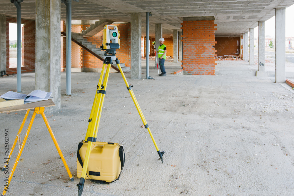
When categorizing laser scanning techniques, the two primary types are terrestrial laser scanning (TLS) and airborne laser scanning (ALS).
Terrestrial Laser Scanning (TLS)
Terrestrial Laser Scanning (TLS): TLS involves mounting a laser scanner on a stationary platform, allowing it to capture detailed information from a specific location. This technique is highly effective for surveying buildings, landscapes, and structures where high detail and accuracy are required. TLS is widely used in applications such as construction, heritage documentation, and forensic investigations.
Airborne Laser Scanning (ALS)Airborne Laser Scanning (ALS): In contrast, ALS utilizes aircraft or drones equipped with laser scanners to cover vast terrains quickly. This method is primarily used for topographic surveys, forest inventories, and large-scale terrain 3D modeling. ALS enables data collection over areas that might be inaccessible by ground, offering rapid, cost-effective surveying solutions especially beneficial in environmental monitoring and urban planning.
Mobile Laser Scanning (MLS)Mobile Laser Scanning (MLS): An emerging hybrid technique, MLS leverages mobile platforms (vehicles or backpacks) equipped with laser scanners, allowing for the collection of data while in motion. This approach offers unparalleled flexibility and is proving valuable for applications where both terrestrial and aerial mapping methodologies may be inadequate.
Each of these techniques presents unique advantages and considerations, allowing surveyors to select the appropriate method based on the specific requirements of their project. As advancements continue in sensor technology, data processing capabilities, and integration with other geospatial technologies, laser scanning remains at the forefront of the surveying field.
In conclusion, understanding the evolution, mechanics, and various methodologies of laser scanning is vital for appreciating its role in modern surveying practices. This knowledge lays a foundational context for exploring its numerous applications and implications, which reflect the expanding scope of geospatial technologies today.
Core Features and Benefits of Laser Scanning Technology
Core Features and Benefits of Laser Scanning Technology
Key Attributes and Benefits
Key Attributes and Benefits
Understanding the Concept and Benefits of Point Cloud Data
At the heart of laser scanning technology lies the creation of point cloud data, which is a collection of data points in a three-dimensional coordinate system that represent the surfaces of physical objects and environments.
Detail and Precision
Point clouds provide an unprecedented level of detail. The dense collection of data points allows surveyors to create 3D models that can be viewed and analyzed from multiple angles, thereby enhancing the accuracy of measurements.
Comprehensive Documentation
Point cloud data serves as a reliable archive of 3D information that can be referenced for future projects, maintenance plans, or historical research.
Facilitates Advanced Analysis
By converting point clouds into mesh surfaces or CAD models, professionals can perform intricate analyses, such as volume calculations, slope assessments, and structural evaluations, which are vital in engineering and environmental assessments.
Interoperability: Point cloud data can be integrated with Geographic Information Systems (GIS) software, enabling layered analysis with other spatial data sets to provide deeper insights into land use, infrastructure planning, or environmental impacts.
Efficiency and Safety Enhancement in Hazardous Environments
One of the most significant advantages of laser scanning technology is its ability to enhance efficiency and safety, particularly in hazardous environments where traditional methods pose risks. Here’s how laser scanning contributes:
Remote Data Collection: Laser scanning allows surveyors to gather data from a distance, minimizing the need for physical presence in potentially dangerous areas, such as construction sites, landslide zones, or near hazardous materials. This reduces the risk of accidents and exposure to harmful elements.
Rapid Data Acquisition: The speed of data capture provided by laser scanning significantly outpaces traditional surveying methods. This rapid data collection translates to shorter project timelines while allowing teams to focus on analysis and decision-making rather than extensive fieldwork.
Increased Accuracy in Assessing Risks: With detailed 3D models generated from point clouds, stakeholders can conduct thorough risk assessments of structural integrity, identifying flaws or potential dangers before they escalate. This proactive approach not only enhances safety but also contributes to cost savings by reducing the likelihood of accidents.
Real-time Monitoring: The integration of laser scanning with real-time monitoring technologies enables ongoing assessment of unstable sites. This capacity for immediate data collection and analysis allows for swift interventions when changes in the environment threaten safety.
Versatility of Laser Scanning in Different Surveying Applications
Versatility of Laser Scanning in Different Surveying Applications
Laser scanning technology’s versatility extends across various sectors, highlighting its application in diverse surveying activities.
Civil Engineering and Construction
Civil Engineering and Construction: Laser scanning aids in measuring and modeling complex structures, ensuring that new constructions align with design specifications. Regular scanning provides continuous updates on project progress and helps in quality assurance.
Architectural Documentation and Restoration
Architectural Documentation and Restoration: In historic preservation, laser scanning captures intricate details of buildings, enabling accurate restorations and renovations while maintaining compliance with heritage guidelines. It allows for capturing conditions and features that may be challenging to document through conventional means.
Infrastructure Management
Infrastructure Management: For utilities and transportation networks, laser scanning is indispensable in mapping assets, planning maintenance, and analyzing the spatial relationship between various elements within infrastructure. It helps in the design and verification of existing conditions with high accuracy.
Environmental and Ecological Studies
Environmental and Ecological Studies: The technology is increasingly applied in environmental monitoring, ecological assessments, and land-use planning. By creating detailed topographical maps, stakeholders can better manage resources, assess environmental impacts, and track changes over time.
Virtual Reality and Animation
Virtual Reality and Animation: The capabilities of laser scanning feed into virtual reality simulations where historical sites can be reconstructed digitally, enhancing public engagement and educational efforts.
In summary, the core features and benefits of laser scanning technology make it an invaluable asset in the field of surveying. With its ability to produce detailed point clouds, increase efficiency and safety, and adapt to various applications, laser scanning continues to transform how geospatial data is collected, analyzed, and utilized across multiple industries.
Recent Advances in Laser Scanning
Recent Advances in Laser Scanning
Innovative Developments
Innovative Developments
1. Integration of Real-Time Data Capture and Processing Tools:1. Integration of Real-Time Data Capture and Processing Tools: The emergence of real-time data capture and processing tools has marked a pivotal advancement in the realm of laser scanning. Traditionally, laser scanning involved a multi-step process where data acquisition and processing occurred separately, leading to delays in obtaining actionable insights. However, with the latest integrated systems, data can be captured from laser scanners and processed simultaneously, allowing for immediate visualization and analysis. This real-time capability enhances the responsiveness of surveying teams and facilitates instantaneous decision-making, especially in fast-paced environments such as construction sites or disaster recovery scenarios. By leveraging cloud computing and advanced algorithms, surveyors can now process vast amounts of data on the fly, resulting in quicker project turnaround times and reduced downtime.
2. Development of Portable and Lightweight Laser Scanning Equipment:2. Development of Portable and Lightweight Laser Scanning Equipment: Recent advancements in materials science and engineering have led to the development of portable and lightweight laser scanning equipment. The traditional bulky laser scanners have seen a transformation into compact, ergonomic devices that can be easily transported and operated in the field. This mobility is especially beneficial when surveying difficult-to-access locations or when conducting inspections in built environments where space is limited. The portability enhances the versatility of laser scanning technology, allowing surveyors to deploy it in various applications from architectural preservation to environmental monitoring without being hindered by cumbersome equipment. The new generation of handheld laser scanning devices is also designed with user-friendly interfaces, making them accessible to a wider range of users, including professionals from non-technical backgrounds.
3. The Impact of Advancements in Data Analysis Software on Workflow Efficiency and Cost-Effectiveness:
Revolutionary Advancements in Data Analysis Software
Advances in data analysis software are transforming laser scanning data interpretation, significantly improving workflow efficiency and cost-effectiveness.
Modern software solutions leverage artificial intelligence and machine learning algorithms to process and analyze point cloud data more effectively.
These tools allow users to create detailed 3D models and generate reports within a fraction of the time previously required.
By streamlining processing workflows and reducing the reliance on manual data handling, software advancements decrease labor costs while increasing data accuracy.
The improved cost-effectiveness of deploying laser scanning technologies translates into broader accessibility for various industries.
Organizations can adopt advanced surveying techniques without substantial financial investments.
Recent advances in laser scanning technology are characterized by innovations that enhance real-time data processing, increase equipment portability, and leverage sophisticated software for improved efficiency.
These developments are shaping the surveying landscape and expanding the possibilities for various applications, from infrastructure monitoring to historical preservation.
As technology continues to evolve, the laser scanning field is poised for further transformation, enabling precise and efficient data collection methods.
For example, in the restoration of historical sites, laser scanning can document fading artifacts or features that may not be visible to the naked eye. This digital archiving allows architects and historians to create comprehensive records of the buildings, which can be utilized in simulation and reconstruction efforts. A notable project involved the documentation of the Notre-Dame Cathedral in Paris following the fire in 2019; laser scanning provided essential data for rebuilding efforts while preserving its historical integrity.
For example, in the restoration of historical sites, laser scanning can document fading artifacts or features that may not be visible to the naked eye. This digital archiving allows architects and historians to create comprehensive records of the buildings, which can be utilized in simulation and reconstruction efforts. A notable project involved the documentation of the Notre-Dame Cathedral in Paris following the fire in 2019; laser scanning provided essential data for rebuilding efforts while preserving its historical integrity.
2. How Laser Scanning is Utilized in Environmental Assessment and Conservation
2. How Laser Scanning is Utilized in Environmental Assessment and Conservation2. How Laser Scanning is Utilized in Environmental Assessment and Conservation
In the realm of environmental assessment and conservation, laser scanning, particularly LiDAR (Light Detection and Ranging), is integral to habitat mapping, forestry surveys, and topographic analyses. By accurately measuring distances to the earth’s surface, LiDAR can assess vegetation structure, enabling experts to evaluate ecosystem health and biodiversity.
In the realm of environmental assessment and conservation, laser scanning, particularly LiDAR (Light Detection and Ranging), is integral to habitat mapping, forestry surveys, and topographic analyses. By accurately measuring distances to the earth’s surface, LiDAR can assess vegetation structure, enabling experts to evaluate ecosystem health and biodiversity.
In the realm of environmental assessment and conservation, laser scanning, particularly LiDAR (Light Detection and Ranging), is integral to habitat mapping, forestry surveys, and topographic analyses. By accurately measuring distances to the earth’s surface, LiDAR can assess vegetation structure, enabling experts to evaluate ecosystem health and biodiversity.
Environmental Assessment and Conservation
Laser scanning, particularly LiDAR (Light Detection and Ranging), is integral to habitat mapping, forestry surveys, and topographic analyses. By accurately measuring distances to the earth’s surface, LiDAR can assess vegetation structure, enabling experts to evaluate ecosystem health and biodiversity.
LiDAR technology enhances forest management by revealing tree height, canopy density, and biomass estimation. This information helps forestry officials make informed decisions about resource management and conservation strategies. Additionally, LiDAR is instrumental in monitoring coastal erosion and mapping wetlands, which are crucial for environmental protection and urban planning. Its ability to create high-resolution digital elevation models supports flood risk analysis and habitat restoration initiatives, showcasing its multifaceted benefits in ecological studies.
Applications in Construction and Project Management
Laser scanning has significantly transformed the construction and project management sectors by enhancing precision and reducing errors in planning and execution. By facilitating as-built documentation, laser scanners allow project managers to compare proposed designs with actual site conditions, leading to informed decision-making and timely interventions.
Laser scanning enables accurate quantity take-offs and progress monitoring by creating detailed 3D models of construction sites. For example, if discrepancies arise during construction, such as misalignment of structural elements, the point cloud data can be analyzed to identify sources of error. Companies can quickly adjust their approaches based on hard data, substantially lowering the risk of costly delays or rework.
Laser scanning enables accurate quantity take-offs and progress monitoring in large-scale infrastructure projects by creating detailed 3D models of construction sites.
Discrepancies during construction can be identified using point cloud data, enabling companies to adjust their approaches and lower the risk of costly delays or rework.
Implementing laser scanning in health and safety audits ensures compliance with regulations and mitigates risks associated with unsafe conditions.
The application of laser scanning technologies in architectural reconstruction, environmental assessment, and construction management highlights its transformative potential across multiple industries.
Benefits of Automation in Geographic Data Collection
Benefits of Automation in Geographic Data Collection
Transforming Data Collection Processes
Automation in geographic data collection stands as a cornerstone in modern geospatial practices, transforming traditional methodologies into streamlined, efficient operations. This transformation is especially noticeable in field data collection processes, where time and resource optimization are critical.
Case Studies Showcasing Increased Efficiency in Field Data Collection:
Case Studies Showcasing Increased Efficiency in Field Data Collection:
Urban Planning Initiatives:
Urban Planning Initiatives: In a case study involving a major metropolitan area, the integration of automated mobile mapping systems facilitated the collection of baseline geographic data in just a few weeks, a process that previously took months with manual surveying techniques. This rapid data acquisition enabled city planners to respond quickly to urban expansion challenges.
Infrastructure Assessment Projects:
Infrastructure Assessment Projects: A transportation department employed drones equipped with advanced imaging technology to automate the monitoring of highway conditions. This initiative reduced the time taken for inspection surveys by over 70%, while providing high-resolution data that supported maintenance scheduling and budget allocation.
Environmental Monitoring Programs:
Environmental Monitoring Programs: An environmental agency utilized automated systems combining satellite imagery with machine learning algorithms to monitor changes in forest cover in a protected region. The systems analyzed vast areas in real-time, providing timely alerts on illegal logging activities while significantly reducing the manpower otherwise required for on-foot inspections.
Changing Workforce Dynamics in Geospatial Industries
Automation is not just improving operational efficiency; it is also reshaping workforce dynamics in the geospatial industry.
Shift in Skill Requirements:Shift in Skill Requirements: As automation becomes more prevalent, the demand for highly specialized skill sets is rising. Workers now require knowledge not only in traditional surveying techniques but also in data analytics, software operation, and machine learning, leading to a shift in educational programs and workforce training initiatives.
Job Displacement and New Opportunities:Job Displacement and New Opportunities: While some traditional roles may be diminishing due to automation, new roles are emerging, particularly in data analysis, AI model development, and technology management. For instance, as mobile mapping systems take over field tasks, there is a growing need for professionals who can interpret and process the high volumes of data generated from these systems.
Improved Work Conditions:Automation allows for safer working environments, especially in hazardous conditions. For example, using drones or automated vehicles for surveying reduces the need for personnel to be exposed to dangerous terrains or unstable structures, ultimately minimizing workplace accidents.
Reducing Human Error Through Automated Systems
Automated systems in geographic data collection promise a significant decline in human error, an endemic challenge in traditional surveying methods.
Increased Data Accuracy:Automated technologies, such as LiDAR and GPS, offer superior precision compared to manual techniques. For example, a study highlighted that transitioning to automated LiDAR systems reduced positional inaccuracies by nearly 50%, enhancing the reliability of geographic datasets used for critical decision-making.
Consistent Data Quality:Automated systems ensure consistent data quality, reducing errors and discrepancies that can occur with traditional methods.
Regular equipment calibration and automated data processing systems ensure high-quality outcomes.
Reduction of Operational Bias:
Automation can mitigate human biases often inherent in data collection and analysis.
In summary, the adoption of automation in geographic data collection marks a significant evolution, fostering enhanced efficiency, reshaped workforce dynamics, and improved accuracy.
Integration of AI and Automation in Geographic Data
Enhancing Processes with Technology
The advancements of geographic data collection and analysis are revolutionizing mobile mapping systems.
Machine Learning Techniques for Data Analysis and Pattern Recognition
Machine learning plays an increasingly fundamental role in geographic data processing.
Supervised Learning:
This technique involves training algorithms on labeled data, enabling them to predict outcomes based on new inputs.
Unsupervised Learning:
By identifying hidden patterns without predefined labels, unsupervised learning aids in clustering similar geographical features together.
Deep Learning:
Deep learning can enhance environmental monitoring by identifying anomalies or changes in land cover dynamics over time.
Neural networks are particularly powerful for processing complex inputs such as 3D point clouds from Lidar data. Deep learning can facilitate the automated extraction of features like buildings or roads from urban landscapes, significantly reducing manual processing time traditionally required in survey contexts.
The application of these advanced ML techniques makes it feasible to transform raw datasets into actionable intelligence, allowing planners and decision-makers to respond rapidly to geographic changes or challenges.
The application of these advanced ML techniques makes it feasible to transform raw datasets into actionable intelligence, allowing planners and decision-makers to respond rapidly to geographic changes or challenges.
Use of AI Algorithms in Predictive Modeling for Urban Planning
Use of AI Algorithms in Predictive Modeling for Urban Planning
AI algorithms are vital in creating predictive models that assist urban planners by simulating various development scenarios and analyzing their potential impacts.
AI algorithms are vital in creating predictive models that assist urban planners by simulating various development scenarios and analyzing their potential impacts.
AI algorithms are vital in creating predictive models that assist urban planners by simulating various development scenarios and analyzing their potential impacts.
Predictive ModelingPredictive Modeling: By integrating historical and real-time data collected from mobile mapping systems, urban planners can predict traffic patterns, population growth, and infrastructure needs. AI-driven simulations optimize resource allocation and test the feasibility of development projects, supporting future urban expansion effectively.
Scenario AnalysisScenario Analysis: AI algorithms enable the creation of various scenarios by adjusting parameters such as zoning regulations and transportation layouts. For example, assessing different urbanization types can predict urban heat island effects, illustrating their implications for sustainability.
The utilization of predictive models empowers urban planners to make data-driven decisions that account for long-term impacts on social and environmental wellness, leading to sustainable urban environments.
The utilization of predictive models empowers urban planners to make data-driven decisions that account for long-term impacts on social and environmental wellness, leading to sustainable urban environments.
Case Studies Demonstrating Successful AI Integration in Geospatial Projects
There are several notable case studies that illustrate the successful integration of AI and mobile mapping technologies in geographic data projects:
City of Los Angeles – AI for Traffic Management
City of Los Angeles – AI for Traffic Management: The city integrated mobile mapping systems with AI algorithms to analyze traffic patterns and predict congestion hotspots. By using deep learning to process video feeds and Lidar data, the city implemented adaptive traffic signal systems, reducing travel times and improving air quality.
Singapore Urban Redevelopment Authority
Singapore Urban Redevelopment Authority: The authority utilized mobile mapping technologies combined with machine learning algorithms to assess urban development implications on residential density and transportation networks. This initiative increased citizen engagement through interactive platforms that visually represent development plans.
Wildfire Risk Assessment in California
Wildfire Risk Assessment in California: AI-driven predictive modeling tools analyzed topography, vegetation data, and historical fire incidents, enhancing risk assessments in wildfire-prone areas. Mobile mapping data provided valuable spatial analysis for effective fire management plans, improving community safety.
These case studies underscore the transformative power of AI and automation in geographic data analysis. They exemplify how these technologies can shape the future of urban planning and environmental management.
In summary, integrating AI and automation in geographic data collection enhances the precision and efficiency of mobile mapping systems. By utilizing machine learning, urban planners can leverage predictive models to drive informed decision-making, addressing the critical challenges in urban development and resource management.
Potential Applications of Geographic Data Automation
Future Directions and Strategies
Future Directions and Strategies
The rapidly evolving field of geographic data automation integrates advanced technologies and methodologies, reshaping our approaches to natural resource management, emergency response, and smart city initiatives. Here, we explore promising applications and the strategies that ensure their success.
The rapidly evolving field of geographic data automation integrates advanced technologies and methodologies, reshaping our approaches to natural resource management, emergency response, and smart city initiatives. Here, we explore promising applications and the strategies that ensure their success.
The Role of Automated Systems in Natural Resource Management
The Role of Automated Systems in Natural Resource Management
Automated geographic data systems are revolutionizing natural resource management by enabling precise monitoring and decision-making in resource allocation. Using mobile mapping systems, drones, and remote sensing technologies, organizations can now collect real-time data on various natural resources—such as forests, water bodies, and agricultural lands—with unparalleled accuracy.
Automated geographic data systems are revolutionizing natural resource management by enabling precise monitoring and decision-making in resource allocation. Using mobile mapping systems, drones, and remote sensing technologies, organizations can now collect real-time data on various natural resources—such as forests, water bodies, and agricultural lands—with unparalleled accuracy.
Resource Monitoring:Resource Monitoring: Automated systems can continuously monitor environmental changes, significantly enhancing our ability to respond to issues like deforestation and water scarcity. For instance, integrating satellite imagery with AI algorithms can effectively track changes in land use patterns over time, enabling proactive management strategies.
Predictive Analytics:Predictive Analytics: By leveraging historical data and advanced modeling techniques, automated geographic data plays a crucial role in predicting resource availability and potential threats. This is especially beneficial in agriculture, where predictive models can determine the best planting times and crop varieties based on current environmental conditions.
Decision Support Systems (DSS):Decision Support Systems (DSS): Automated geographic data integrates into Decision Support Systems, aiding environmental managers in making informed, data-backed decisions. These systems can simulate various scenarios for resource extraction or conservation efforts, which improves efficacy and engages stakeholders effectively.
Case Examples in Emergency Response Planning and Execution
The role of automation in emergency response planning can save lives and resources by utilizing real-time geographic data. Automated systems streamline information gathering and enhance operational coordination during crises.
Disaster Management Systems: Automated mapping technologies are essential for assessing damage after natural disasters. For instance, during Hurricane Harvey, data from mobile mapping systems created rapid assessments of flooding scenarios, enabling first responders to prioritize rescue operations in the hardest-hit areas.
Crisis Simulations: Geographic automation supports scenario planning exercises by modeling potential emergency situations, offering planners vital insights into resource needs and response strategies. This approach has proven effective in wildfire management, where automated systems provide simulations to predict fire spread and improve resource allocation decisions.
Integrated Data Platforms: Platforms like the National Oceanic and Atmospheric Administration (NOAA) utilize automated systems to amalgamate various data sources, including weather patterns, population densities, and infrastructure information. This integrated approach fosters comprehensive decision-making during emergencies.
Benefits of Automated Geographic Data in Smart City Initiatives
As cities evolve into smart cities, the automation of geographic data becomes pivotal in urban development and management initiatives.
Urban Planning: Automated geographic data enables urban planners to make evidence-based decisions that enhance city livability and sustainability. For example, automated traffic data collection systems optimize traffic management and inform public transport planning initiatives.
Real-Time Infrastructure Monitoring: Automated geographic data supports real-time infrastructure monitoring, enabling cities to respond promptly to maintenance needs and minimize disruptions.
Citizen Engagement: Smart cities leverage geographic data to enhance community involvement in urban development. Interactive platforms and dashboards provide citizens with real-time data on urban issues, facilitating crowd-sourced solutions to local problems.
Sustainability Efforts: Geographic data automation supports environmental sustainability efforts within smart city contexts. Automated systems track emissions levels, energy usage, and green space distribution, enabling cities to modify policies and practices aimed at reducing their ecological footprint.
The potential applications of geographic data automation span across various sectors and demonstrate the importance of integrating advanced technologies into societal frameworks. From resource management to emergency response and urban planning, automated systems not only improve operational efficiency but also pave the way for more strategic, data-informed decision-making.
The future of these technologies heralds a more interconnected and responsive approach to addressing the complex challenges faced by societies globally.
Interconnections with Related Fields
12. Interconnections with Related Fields
Exploring Collaborative Technologies
1. The Enhancement of Mobile Mapping Capabilities through Robotics
Robotics and mobile mapping systems are increasingly intersecting, leading to significant enhancements in data collection capabilities.
Risks for human surveyors are alleviated as robots equipped with mobile mapping technologies navigate and survey challenging environments autonomously.
The automation of tasks accelerates the data collection process and increases safety as robots operate in hazardous terrains during natural disasters or within contaminated areas.
Applications such as drones for aerial mapping exemplify this synergy.
Drones equipped with high-resolution cameras and Lidar scanners provide real-time data from vantage points unreachable by traditional surveying methods.
Ground-based robotic platforms traverse uneven landscapes to collect detailed terrestrial data, ensuring comprehensive spatial coverage.
Such robotic systems, integrated with advanced algorithms for path planning and obstacle avoidance, facilitate accurate and efficient data collection while minimizing human intervention.
Machine Vision: Elevating Data Collection Accuracy
Machine vision technology enhances the accuracy of data collection in mobile mapping systems.
Machine vision algorithms analyze images to detect features, identify objects, and assess environmental conditions, leading to a more nuanced understanding of collected data.
Machine vision technology plays a critical role in enhancing the accuracy of data collection in mobile mapping systems. By employing cameras capable of interpreting visual information, mobile mapping applications can gain insights beyond simple spatial dimensions. Machine vision algorithms analyze images to detect features, identify objects, and assess environmental conditions, leading to a more nuanced understanding of collected data.
Machine vision technology plays a critical role in enhancing the accuracy of data collection in mobile mapping systems. By employing cameras capable of interpreting visual information, mobile mapping applications can gain insights beyond simple spatial dimensions. Machine vision algorithms analyze images to detect features, identify objects, and assess environmental conditions, leading to a more nuanced understanding of collected data.
3. Collaborative Frameworks for Data Sharing Among Geospatial Professionals
The complex nature of modern mapping and surveying requires collaboration among various professionals in the geospatial field, leveraging different technologies and skill sets. Establishing collaborative frameworks facilitates data sharing among geospatial professionals and organizations, leading to more comprehensive and accurate datasets.
For example, in urban settings, machine vision can facilitate the recognition of street furniture, road markings, and traffic signs, which are essential for traffic management systems and autonomous vehicle navigation. Integrating machine vision with mobile mapping ensures high-resolution, context-rich data is gathered for various applications, such as smart city planning and infrastructure management. Furthermore, combining machine vision with machine learning techniques allows for real-time data analysis, where the system can adaptively refine its accuracy based on user feedback and environmental changes.
For example, in urban settings, machine vision can facilitate the recognition of street furniture, road markings, and traffic signs, which are essential for traffic management systems and autonomous vehicle navigation. Integrating machine vision with mobile mapping ensures high-resolution, context-rich data is gathered for various applications, such as smart city planning and infrastructure management. Furthermore, combining machine vision with machine learning techniques allows for real-time data analysis, where the system can adaptively refine its accuracy based on user feedback and environmental changes.
The complex nature of modern mapping and surveying requires collaboration among various professionals in the geospatial field, leveraging different technologies and skill sets.
These frameworks often rely on cloud-based platforms that enable real-time sharing and access to mapping data, allowing multiple users to collaborate on projects from various locations.
Such systems can incorporate standards like Open Geospatial Consortium (OGC) protocols, ensuring interoperability between different software tools and data formats.
Moreover, these collaborative technologies encourage partnerships among academia, industry, and governmental bodies, further enriching the geospatial knowledge base and driving innovation.
For instance, cities can benefit from real-time mapping data shared by different agencies—transportation departments can inform urban planners about road conditions, while environmental agencies can provide insights on land use changes or natural resource management.
By collaborating within these frameworks, stakeholders can make informed decisions, ultimately leading to smarter and more efficient urban environments.
The interconnections between mobile mapping systems and related fields such as robotics, machine vision, and collaborative frameworks indicate a growing trend toward integration and synergy in technology.
By leveraging these interdisciplinary approaches, the efficacy of mobile mapping continues to expand, pushing the boundaries of what is possible in field surveying and geospatial analysis.
These developments not only improve operational efficiency but also have far-reaching implications for urban planning, environmental management, and public safety, demonstrating the transformative impact of modern mapping technologies on society.
Mobile Mapping Systems and Related Fields
Indicate a growing trend toward integration and synergy in technology.
By leveraging these interdisciplinary approaches, the efficacy of mobile mapping continues to expand, pushing the boundaries of what is possible in field surveying and geospatial analysis.
These developments not only improve operational efficiency but also have far-reaching implications for urban planning, environmental management, and public safety.
Demonstrating the transformative impact of modern mapping technologies on society.