A plan is a drawing; in the context of measured building survey and topographical surveys, it represents the features on your property on a PDF or DWG drawing. These are used for your planning application and for your architect to produce your construction (proposed) drawings. According to the UK Government’s Planning Portal, plans are a crucial aspect of the planning application process, as they provide essential information about the property’s layout and boundaries (Source: UK Government’s Planning Portal). There are several types of plans, each serving a specific purpose in the planning process.
- Floor Plans
- Section Plans
- Roof Plans
- Loft Plans
- Elevation Plans
- Topographical Plans (or also called Land Survey Plans)
- Ceiling Plans
It’s essential to note that plans are not the same as site plans. A site plan is a drawing/illustration that shows your property in context to other properties. It is based on an Ordnance map and can be purchased online, with prices ranging from £8-10, depending on the scale (Source: BuyAPlan.co.uk). You need one for all planning applications. A site plan provides a visual representation of the property’s location and boundaries, which is vital for the planning process.
Here are some examples of the plans mentioned above:
floor plans are a crucial aspect of the planning process, providing a detailed representation of the property’s layout and boundaries. They are typically created using CAD software and are used to produce construction drawings (Source: Architects’ Journal). Floor plans can be customized to meet specific requirements, making them an essential tool for architects and developers.
Section plans provide a detailed representation of a specific section of the property, such as a wall or a room. They are useful for highlighting architectural features and can be used to create 3D models of the property (Source: ArchDaily). Section plans can be created using various software tools, including CAD and BIM.
Roof plans are a critical component of the planning process, as they provide essential information about the property’s roof structure and layout. They are typically created using CAD software and are used to produce construction drawings (Source: Building Design). Roof plans can be customized to meet specific requirements, making them an essential tool for architects and developers.
loft plans are a type of floor plan that focuses on the property’s loft space. They are useful for highlighting architectural features and can be used to create 3D models of the property (Source: The Guardian). Loft plans can be created using various software tools, including CAD and BIM.
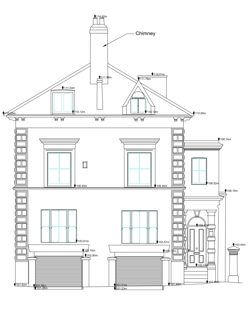
Elevation plans provide a detailed representation of the property’s exterior, including walls, windows, and doors. They are typically created using CAD software and are used to produce construction drawings (Source: The Times). Elevation plans can be customized to meet specific requirements, making them an essential tool for architects and developers.
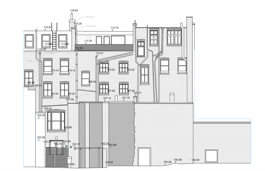
Topographical plans, also known as land survey plans, provide a detailed representation of the property’s boundaries and layout. They are typically created using CAD software and are used to produce construction drawings (Source: The Telegraph). Topographical plans can be customized to meet specific requirements, making them an essential tool for architects and developers.
ceiling plans provide a detailed representation of the property’s ceiling layout and features. They are typically created using CAD software and are used to produce construction drawings (Source: Building Design). Ceiling plans can be customized to meet specific requirements, making them an essential tool for architects and developers.
Floor Plan Example 3 serves as a crucial step in the architectural design process. It allows designers to visualize the layout and proportions of a space, making it easier to identify potential issues and optimize the design.
Section Plan Example 1 provides a detailed view of a specific section of the building, allowing designers to examine the relationships between different elements and components.
Section Plan Example 2 showcases a more detailed and complex section of the building, highlighting the relationships between different components and systems.
Topographical Plan Example provides a visual representation of the building’s site and its relationship to the surrounding environment.
Loft Plan Example provides a detailed view of the building’s interior spaces, highlighting the relationships between different components and systems.
Elevation Plan Example showcases a detailed view of the building’s exterior, highlighting the relationships between different components and systems.