What is a Plan, is this a drawing?
A plan is a drawing; in the context of measured building survey and topographical surveys it represents the features on your property on a PDF or DWG drawing. These are used for your planning application and for your architect to produce your construction (proposed) drawings. There are several types of plans. They are:
- Floor Plans
- Section Plans
- Roof Plans
- Loft Plans
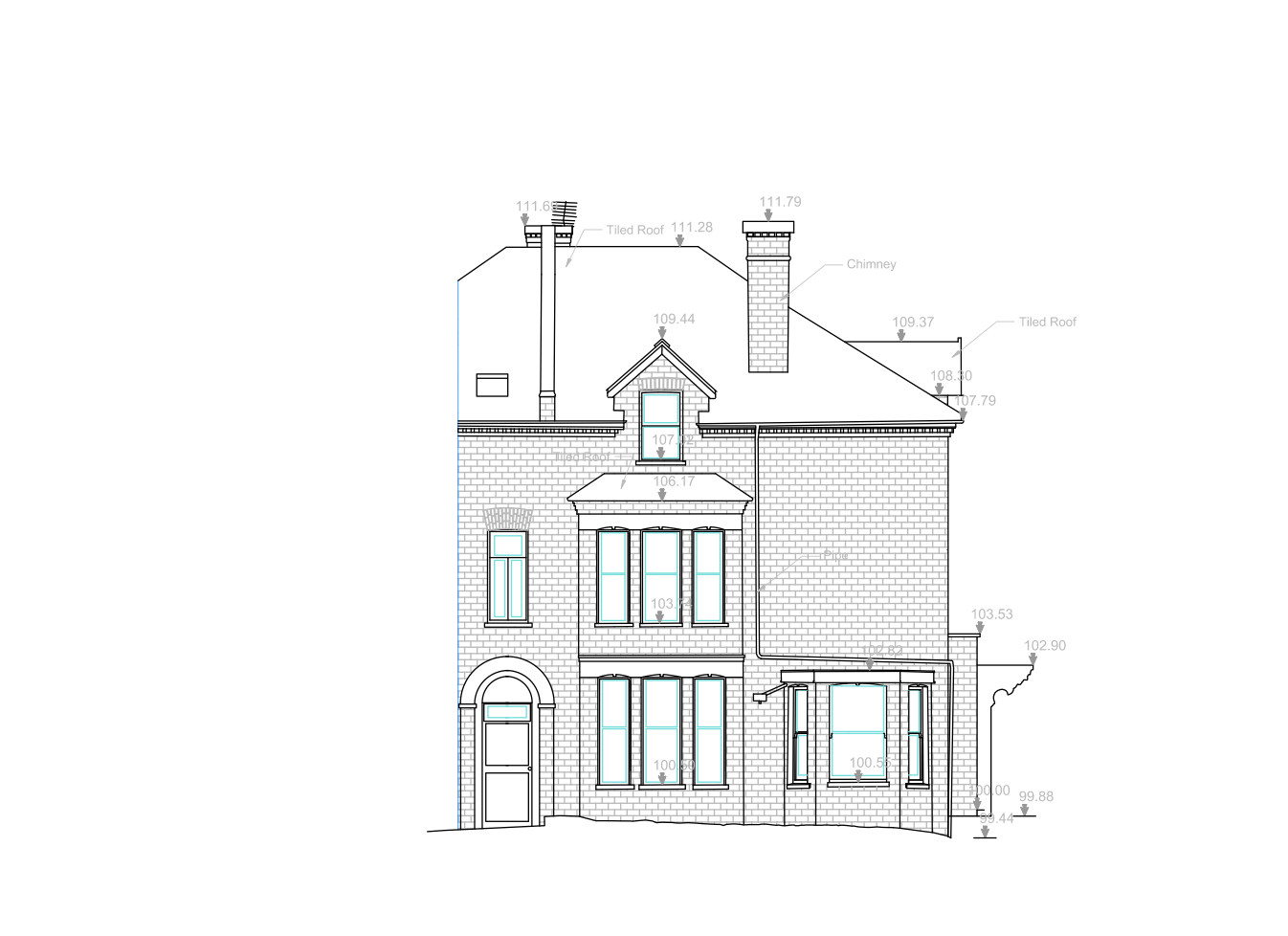
- Elevation Plans (there are also internal and external plans, most of the requests are just external plans. The only time you need an internal plan is when you have detail artwork or ornate walls that needs to be represented on your measured building survey)
- Topographical Plans (or also called Land Survey Plans)
- Ceiling Plans
You should not confuse it with a site plan. A site plan is a drawing/illustration that shows your property in context to other properties. It is based on an Ordnance map and can be purchased online (for roughly £8-10; depending on the scale https://www.buyaplan.co.uk/ ). You need one for all planning application.
A site plan looks like this:

Here are some examples of the plans mentioned above:
Floor Plans


Section


Topographical planLoft Plan

Elevation