Category: Elevation

  • What is a Measured Survey?

    A Measured Survey is a detailed drawing showing the dimensions, locations, and permanent features of your property, which can be a building or land.

    This type of survey is essential for identifying the layout of your property and its permanent attributes.

    According to the Royal Institution of Chartered Surveyors (RICS), measured surveys are usually drawn up to a scale of 1:100 for buildings, 1:50 for listed buildings, and 1:250 for land.

    The location of your property is determined by GPS (Global Navigation Satellite System) coordinates or can be created locally specifically for your property.

    The positions are relative to their reference points, such as GPS or the local established control points.

    The Land Registry emphasizes the importance of accurate location data, which is then used to establish the property’s boundaries and create a definitive record.

    Permanent features are a crucial aspect of a measured survey, as they define the characteristics of your property.

    • Walls
    • Windows
    • Doors
    • Beams
    • Columns
    • Built-in cabinets/wardrobes
    • Ponds
    • Trees
    • Pavement
    • Street furniture

    According to the UK’s Planning Portal, permanent features can be used to distinguish between buildings and land, and are often referenced in planning applications and insurance policies.

    As highlighted by the Royal Institution of Chartered Surveyors (RICS), measured surveys provide a detailed record of these features, allowing for accurate assessments and decision-making.

  • How to get Existing Plans of Your Property?

    How to get Existing Plans of Your Property?

    A measured survey is a type of survey that involves creating a detailed record of the size, shape, and dimensions of a building or land area.

    According to a study by the Royal Institution of Chartered Surveyors (RICS), a measured survey is used to provide an accurate assessment of a property’s value and to support negotiations in property transactions.

    This type of survey is essential for both buyers and sellers, as it provides a comprehensive understanding of the property’s features and limitations.

    Existing plans for home owners refer to the detailed drawings and specifications of a property that have been created by a surveyor or architect.

    These plans typically include information about the property’s layout, room sizes, and architectural features.

    A surveyor can use these plans to identify any defects or issues with the property, and to provide a detailed report on the property’s condition.

    A study by the UK’s Building Control magazine found that existing plans are essential for home owners, as they provide a clear understanding of the property’s features and limitations, and can help to identify potential defects or issues.

    In conclusion, a measured survey is a crucial process that involves creating a detailed record of a building or land area.

    Existing plans for home owners are essential for providing a clear understanding of a property’s features and limitations.

    By using these plans, home owners can identify potential defects or issues with their property, and make informed decisions about their investment.

    References

    • What is a Section Plan?

      What is a Section Plan?

      Definition

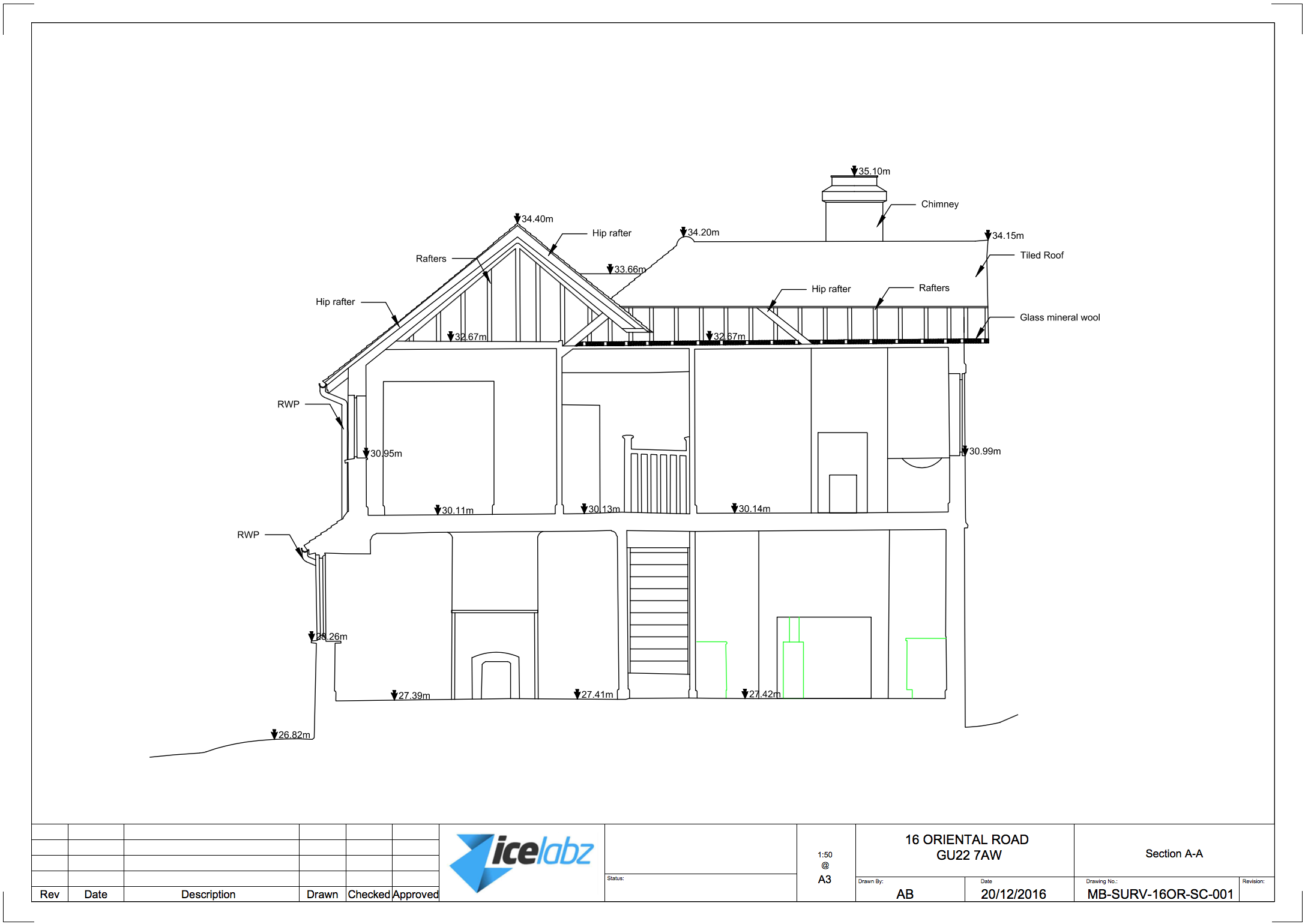
      A section plan is a 2D drawing of your house, showing it from all angles vertically. It’s a bird’s eye view of your home, from the side (well..through the house). It also shows the interior and exterior walls.

      Section plan is a type of drawing that shows the internal features of a property.

      The section plan is usually combined with other plans on a measured building survey.

      Section plans are used by architects to get an idea of the height of internal floors and features on the wall.

      Section plans can be produced from floor plans and elevations, but it may take longer for someone who has not visited the house.

      Section plans are usually drawn in the middle of the property’s staircase.

      Section plans are used to communicate with builders or renovators to show what work needs to be done.

      Some Examples

    • A section plan is a graphic representation of a building or object, usually in cross-section.
    • A section plan can be used to show the arrangement of different rooms, spaces and/or levels within an interior environment.
    • You can use a section plan for your own home or for any other building or vehicle you might want to see in details
    • Here are some examples of a section plan:

      It is important to note (to avoid confusion):

      The difference between an elevation and a section is that the elevation shows the external vertical plan of the building and the section shows the internal.

      Sample Section plan in PDF:


      MB-SURV-BR-SECA-001
      Download

      How to Draw a Section Plan

      There are a few different ways to create a section plan. One common method is by hand, but it’s also possible to use software such as AutoCAD or SketchUp. To start, you’ll need to draw a 2D line drawing of your house.

    • You would want to start to draw up all your floor plans first so that you can get the layout and vertical dimensions (room height, door height and windows).
    • Once you’re done you have to draw your section line and which direction you need to draw.
    • then you would want to start aligning the floors against your section so that you can draw your internal of your house, then your height of each floor.
    • Then the hardest part is what you see from the section line. Check out the examples above to give you an idea of what features to pick
    • Then you can add labels and dimension lines on the house plans to indicate height, depth, and width as well as material types and construction details. Labels are useful for showing the location of rooms and other features on your building as well as giving an overview of any special structural elements that might be present in your home (such as trusses).

      Interior designer making hand drawing pencil sketch of a bathroom

      Interior design

      How to read or draw a section plan.

      How to read or draw a section plan.

      A section plan is a drawing that shows the cross-section of a building. It can be drawn to show all of the floors, or it can show just one floor.

      A section plan is different from an elevation, which shows an outside view of your house. A section plan shows how your house looks from inside or underneath it.

      Understanding Section Plans

      A section plan is a valuable resource for understanding your house’s construction, offering insights into its internal layout and materials used.

      A section plan provides a detailed drawing of a house in cross-section, showcasing how the house is built from the foundation to the roof.

      • The layout of each room in your house
      • Materials used within each room, such as wood, stone, and metal
      • How different parts of the house connect together, like walls with floors

      Still confused about section plans?

      Take a look at an article on elevations for further understanding.

  • What is a Plan, is this a drawing?

    What is a Plan, is this a drawing?

    A plan is a drawing; in the context of measured building survey and topographical surveys, it represents the features on your property on a PDF or DWG drawing. These are used for your planning application and for your architect to produce your construction (proposed) drawings. According to the UK Government’s Planning Portal, plans are a crucial aspect of the planning application process, as they provide essential information about the property’s layout and boundaries (Source: UK Government’s Planning Portal). There are several types of plans, each serving a specific purpose in the planning process.

    • Floor Plans
    • Section Plans
    • Roof Plans
    • Loft Plans
    • Elevation Plans
    • Topographical Plans (or also called Land Survey Plans)
    • Ceiling Plans

    It’s essential to note that plans are not the same as site plans. A site plan is a drawing/illustration that shows your property in context to other properties. It is based on an Ordnance map and can be purchased online, with prices ranging from £8-10, depending on the scale (Source: BuyAPlan.co.uk). You need one for all planning applications. A site plan provides a visual representation of the property’s location and boundaries, which is vital for the planning process.

    Here are some examples of the plans mentioned above:

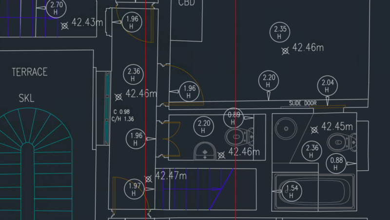
    floor plans are a crucial aspect of the planning process, providing a detailed representation of the property’s layout and boundaries. They are typically created using CAD software and are used to produce construction drawings (Source: Architects’ Journal). Floor plans can be customized to meet specific requirements, making them an essential tool for architects and developers.

    Section plans provide a detailed representation of a specific section of the property, such as a wall or a room. They are useful for highlighting architectural features and can be used to create 3D models of the property (Source: ArchDaily). Section plans can be created using various software tools, including CAD and BIM.

    Roof plans are a critical component of the planning process, as they provide essential information about the property’s roof structure and layout. They are typically created using CAD software and are used to produce construction drawings (Source: Building Design). Roof plans can be customized to meet specific requirements, making them an essential tool for architects and developers.

    loft plans are a type of floor plan that focuses on the property’s loft space. They are useful for highlighting architectural features and can be used to create 3D models of the property (Source: The Guardian). Loft plans can be created using various software tools, including CAD and BIM.

    Elevation plans provide a detailed representation of the property’s exterior, including walls, windows, and doors. They are typically created using CAD software and are used to produce construction drawings (Source: The Times). Elevation plans can be customized to meet specific requirements, making them an essential tool for architects and developers.

    Topographical plans, also known as land survey plans, provide a detailed representation of the property’s boundaries and layout. They are typically created using CAD software and are used to produce construction drawings (Source: The Telegraph). Topographical plans can be customized to meet specific requirements, making them an essential tool for architects and developers.

    ceiling plans provide a detailed representation of the property’s ceiling layout and features. They are typically created using CAD software and are used to produce construction drawings (Source: Building Design). Ceiling plans can be customized to meet specific requirements, making them an essential tool for architects and developers.

    Floor Plan Example 3 serves as a crucial step in the architectural design process. It allows designers to visualize the layout and proportions of a space, making it easier to identify potential issues and optimize the design.

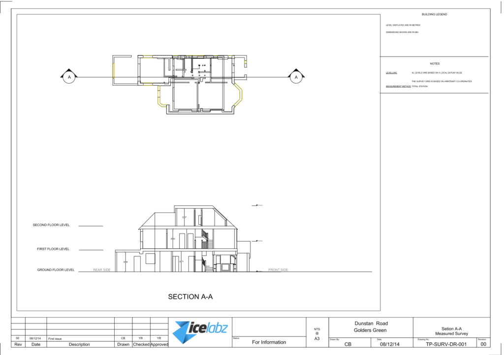
    Section Plan Example 1 provides a detailed view of a specific section of the building, allowing designers to examine the relationships between different elements and components.

    Section Plan Example 2 showcases a more detailed and complex section of the building, highlighting the relationships between different components and systems.

    Topographical Plan Example provides a visual representation of the building’s site and its relationship to the surrounding environment.

    Loft Plan Example provides a detailed view of the building’s interior spaces, highlighting the relationships between different components and systems.

    Elevation Plan Example showcases a detailed view of the building’s exterior, highlighting the relationships between different components and systems.
    References